Photos
No verified photographs of the cave entrance or interior have been added yet.
Sauliac-sur-Célé · Lot (46) · France 
Grotte-émergence d’Anglanat is a karst cave above the D41 road between Sauliac-sur-Célé and Cabrerets. It is thought to act as an overflow outlet for the nearby Fontaine d’Anglanat during floods. The cave entrance and the spring are distinct locations.
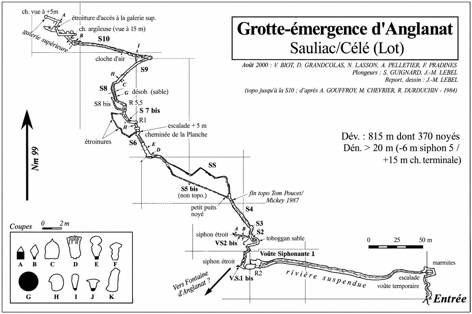
Historical descriptions refer to an initial “suspended river” of approximately 200 metres, with pools (gours), followed by several sumps and passages. The 1999 survey shows sumps S1–S10. The survey records 815 metres of passage, including 370 metres submerged; these are historical exploration figures, not current dive-route specifications.
At low water, high CO₂ concentrations were reported inside the cave, except beyond sump S10. At flood levels, water can surge through the cave and discharge at the entrance. Narrow passages, sediment and changing conditions add further risks. Do not use historical survey data as an operational dive plan.
Historical survey of Grotte-émergence d’Anglanat, showing sumps S1–S10, dry galleries and the suspended river. Click the image to enlarge.
Survey attribution is reproduced from the supplied historical image. Publication or redistribution rights have not been independently verified.
Sauliac-sur-Célé, France
📍 Open in Google Maps →GPS: 44.518533, 1.694726 — provisional cave entrance; Fontaine d’Anglanat is a separate unverified location.
This page is based on historical documentation supplied by the site owner and the published survey. Present-day cave conditions, access rights and entrance position have not been independently confirmed.