📷 Photos
View photos →
📍 Lanzac · Lot (46) · Occitanie, France
An extensive cave system with multiple sumps and long dry sections, close to the Dordogne.
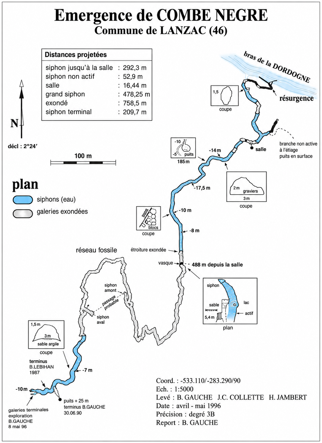
Émergence de Combe Nègre is located near Lanzac in the Lot, close to the Dordogne. The system differs from many other springs in the region through its alternation of underwater passages and long dry sections. The known development is approximately 2.4 kilometres.
The cave consists of a series of at least seven sumps. S1 is about 70 m long, followed by a short dry section and S2 of about 50 m. A roughly 20 m long fissure leads to S3, which is about 150 m long. Farther on are S4 (±20 m), S5 (±500 m, to about −15 m), S6 (±30 m) and a long dry section. This is followed by S7, explored for about 180 m, with a short terminal gallery beyond it.
Modern exploration began in 1973 when Georges Dages cleared the entrance and, together with Michel Thomas, began exploring the first sump. In 1976 Jean-Louis Camus and Bertrand Léger reached S5 and M. Verlhac surveyed the cave. In 1979 Bernard Le Bihan and Pierre Laureau passed S5 and explored about 970 m of dry galleries. Further exploration followed in 1987 and 1990.
The survey shows the plan of the system, the successive sumps, dry galleries, important depths and several cross-sections.
Lanzac, France
Practical information about parking, walking distance and GPS coordinates is based on personal field data. Cave conditions, access and local arrangements may change; always check these before a dive.