📷 Photos
View photos →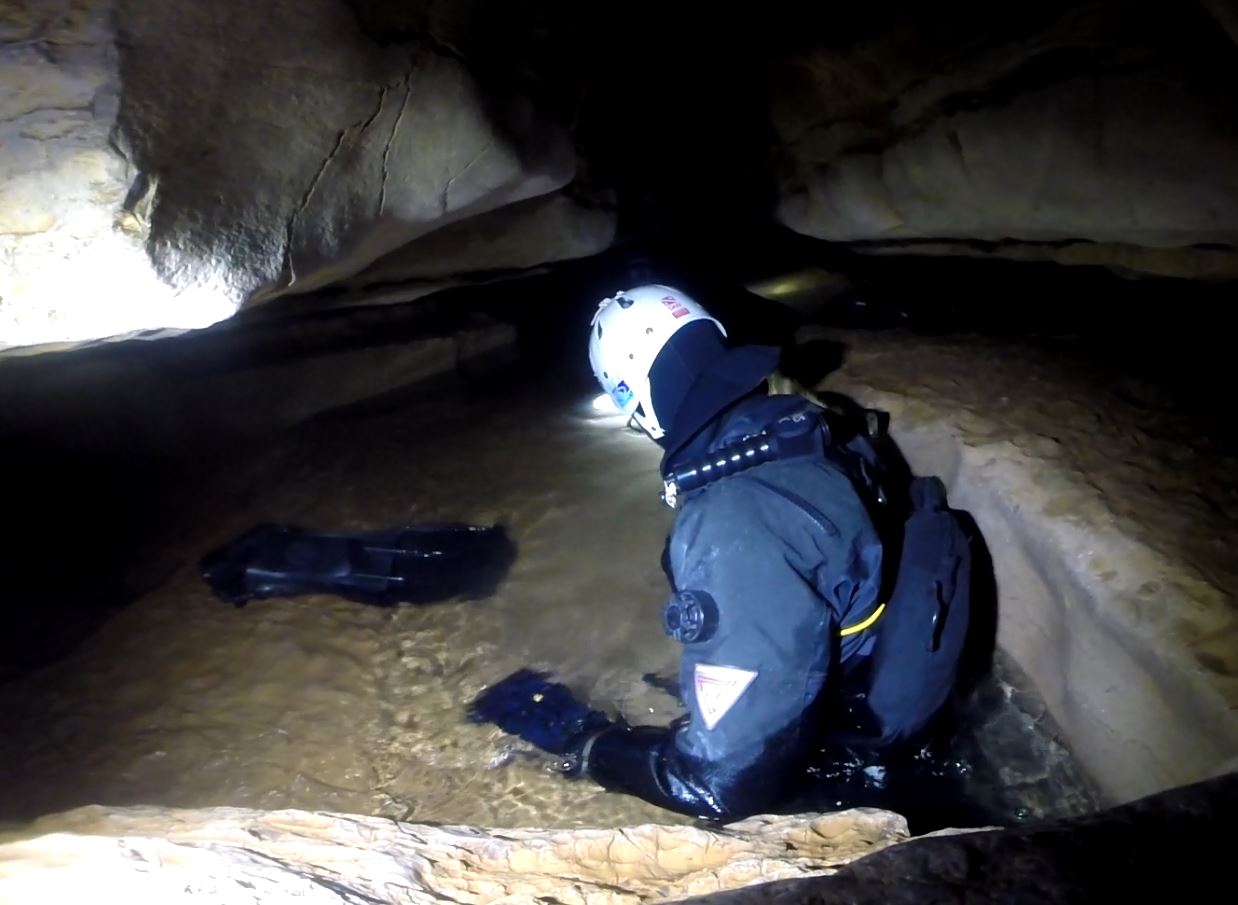
📍 Crégols · France
A distinctive cave-diving site in the Lot with a short first sump, a physical dry intermediate section and a deep second sump.
Crégols is not a cave where you simply make a long underwater penetration from the entrance. The transition between the first and second sump largely defines the character of the dive.
Historical documentation describes a short first sump, followed by a spacious dry gallery and then Sump 2. The exploration report also mentions a step of about 5 metres in the boulder choke after S1. The second sump was historically explored for approximately 450 metres, with a long deep section around -47 to -48 metres. The published overview from this exploration phase gives a total development of 620 metres, of which 500 metres are underwater.
The spring is part of a captured water-supply system. The municipality of Crégols states that the springs near the village are used to supply drinking water to 23 municipalities and describes the main spring as an internationally known cave-diving site for experienced divers.
The drawings below document different parts and exploration phases of the Crégols system. They are presented here as historical topographic sources; the development shown does not necessarily correspond to the complete current knowledge of the system.
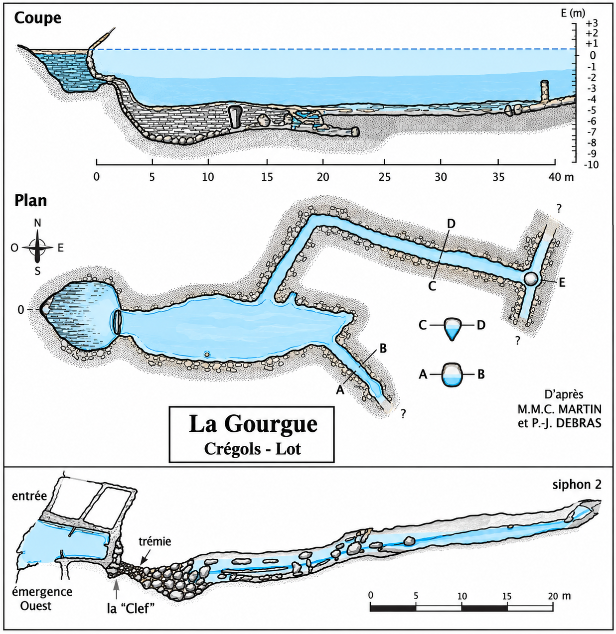
La Gourgue – Crégols: plan, profile and cross-section of the entrance zone. The supplied drawing states: “D’après M.M.C. Martin et P.-J. Debras”.
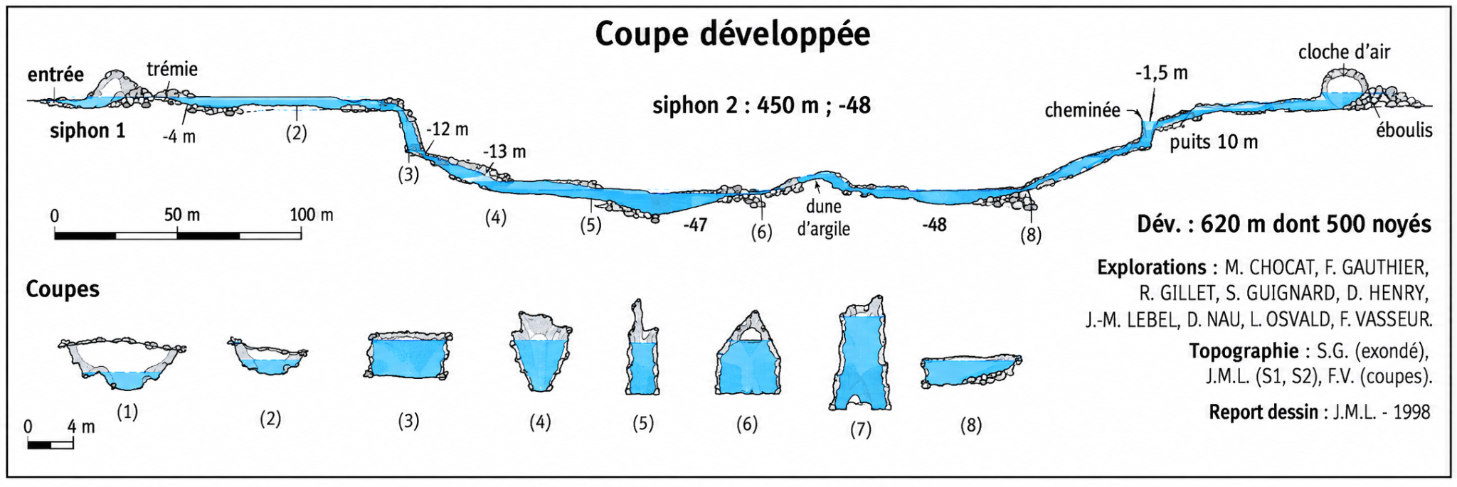
Coupe développée: Siphon 2 450 m / -48 m; Dév. 620 m dont 500 noyés. Explorations: M. Chocat, F. Gauthier, R. Gillet, S. Guignard, D. Henry, J.-M. Lebel, D. Nau, L. Osvald en F. Vasseur. Topographie: S.G. (exondé), J.M.L. (S1, S2), F.V. (coupes). Report dessin: J.M.L. – 1998.
Crégols, France
Practical information on parking, walking distance, configuration and DPV is based on our own experience on site. Cave conditions, access and local arrangements can change; always check them before a dive.