🏛️ DepartmentLot (46)
📍 LocationMontvalent
📌 Cave GPS44°53′22.6″N 1°37′08.3″E ↗
🅿️ Parking GPS44°53′22.7″N 1°37′03.8″E ↗
↕ Max. depth±78 m
↔ Development±1.580 m S1 + S2
🗺️ TopoView maps ↓
Character of Fontaine de Saint-Georges
Fontaine de Saint-Georges lies near Montvalent and is the main active resurgence of the underground river of the Gouffre de Padirac. The spring pool is about 30 metres in diameter. From the pool, a passage is reached at around -10 m that descends steeply over gravel to approximately -29 m. The cave then opens into a considerably larger gallery.
The first sumps
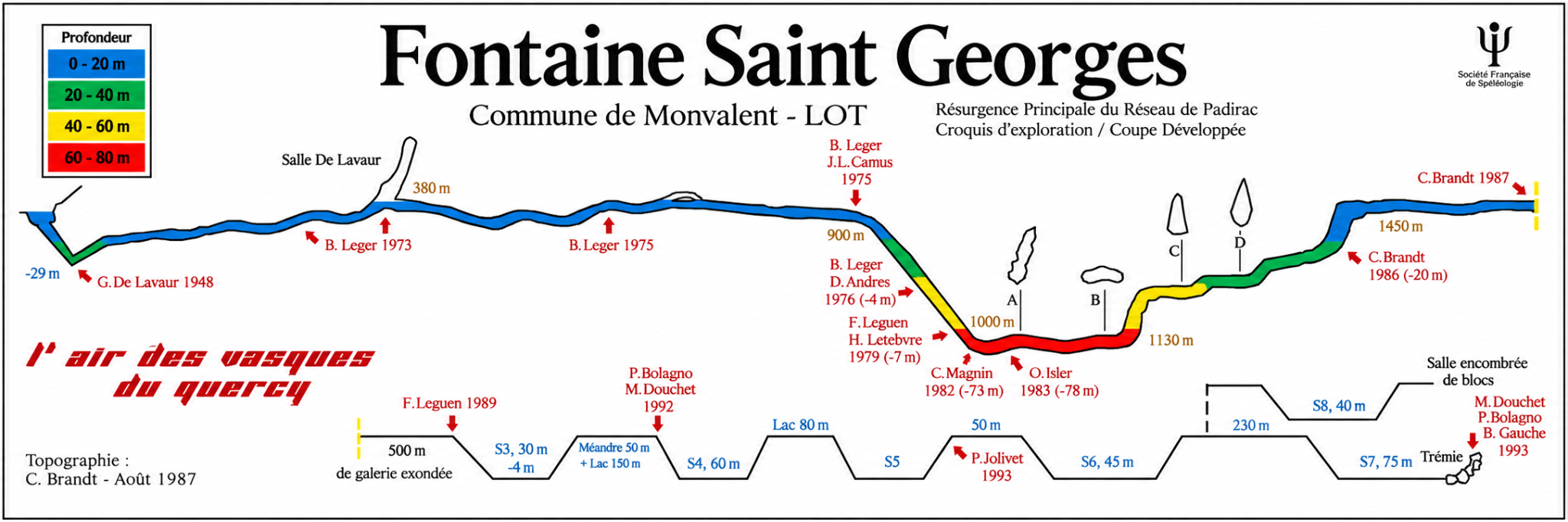
S1 extends for about 350 metres to a large air chamber with a high ceiling. S2 is much longer: for the first approximately 700 metres, the average depth is around -12 to -15 m. The profile then drops steeply to about -76 to -78 m and resurfaces after approximately 1,230 metres. A dry gallery of about 420 metres then leads to the next sumps.
🧭 Connection with Padirac
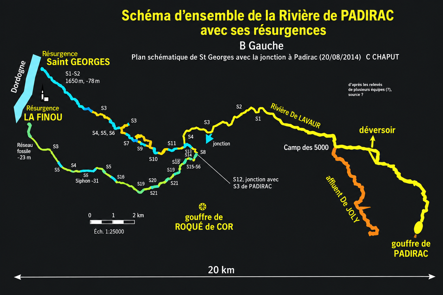
Saint-Georges is part of the extensive Padirac system. In 2003, Rick Stanton established the connection between the twelfth sump of Saint-Georges and the fifth sump downstream from Padirac. In October 2014, Clément Chaput completed the traverse from Saint-Georges to the Gouffre de Padirac.
🔎 Exploration history
The exploration history goes back to Guy de Lavaur in 1948. Between 1973 and 1975, the underground river was explored to more than a kilometre from the spring. Cyrille Brandt passed S2 in 1987. Later explorations ultimately connected the Saint-Georges network with Padirac.
Explore this location
.jpg)
.jpg)
▶ Videos
View videos →▶Video coming soon
Fontaine de Saint-Georges · cave-diving video
🗺️ Topography Fontaine de Saint-Georges
The topography shows the longitudinal profile of the main passage, the different sumps, side passages and important depths.
COUPE DÉVELOPPÉE · longitudinal profile
PADIRAC SYSTEM · overview
Topography: C. Brandt · August 1987. Original source and author credits on the topography have been retained.
Copyright: the topographies are historical source material. freijer.eu claims no copyright in the original topographic content or drawings. Source and author credits have been retained.
🗺️ Location
Montvalent, Lot, France
📍 Open in Google Maps →ℹ️ Practical information
ParkingLimited parking, with space for approximately 3–4 cars. Do not park along the riverbanks.
Walking distanceApproximately 100 metres from the parking area to the water.
AccessA short path leads from the parking area to the large spring pool.
ConfigurationFull cave-diving equipment; adapt equipment and gas planning to the planned dive.
Special considerationsDeep and extensive cave system. Take local conditions into account.
PermissionCheck the local situation and any current access arrangements in advance.
DPVDPV permitted.
Sources
Description and exploration history: Fédération Française de Spéléologie / Plongée Souterraine and FFESSM Commission Plongée Souterraine. GPS coordinates, parking information and walking distance are the location data used for this website.
FFS – Saint Georges Montvalent · FFESSM – traversée Saint-Georges–Padirac