📷 Photos
View photos →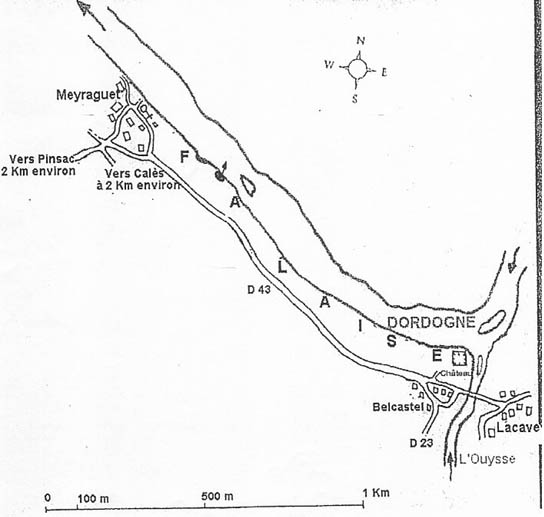
No original entrance or cave photographs have been provided. The image below is a historical location map, not a photograph.
📍 Lacave · Lot (46) · Occitanie, France
A distinctive cave on the Dordogne with two sumps and a hazardous air chamber.
Émergence de Meyraguet is situated near Lacave on the banks of the Dordogne in the Lot department. The entrance is directly on the river. Access is highly dependent on water levels.
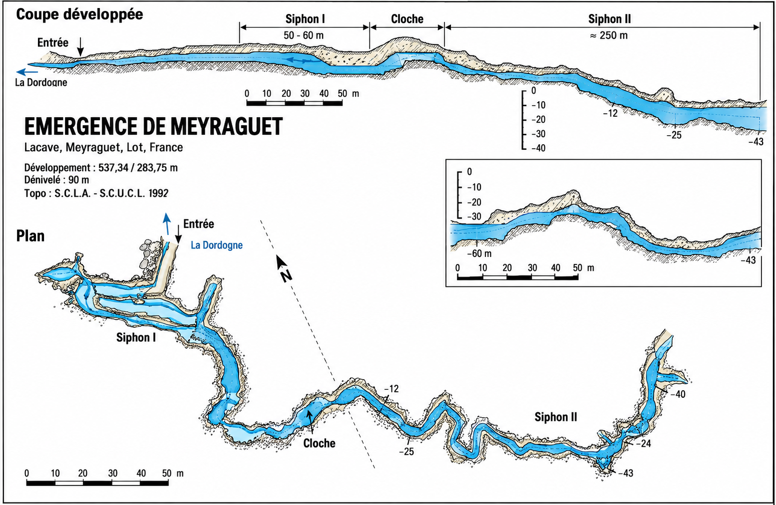
According to a 2004 account, an approximately 80–100 m dry passage leads to the first sump (about 50–60 m). This is followed by an air chamber (cloche) containing stalactites, and then a second sump descending through winding passages to around 40 m. The historical survey indicates a maximum depth of approximately −43 m.
Visibility can initially be good, but disturbed fine sediment may rapidly reduce it to zero. This historical description is not current diving or route guidance.
In November 2003, two experienced cave divers died in the air chamber between the sumps. Oxygen concentrations of only 8.8% and 9.2%, together with elevated CO₂, were measured on 20 and 21 November 2003. The atmosphere can be fatal and may change over time. Never breathe ambient gas in the chamber; keep your regulator in your mouth. This information does not replace a current safety assessment.
No original entrance or cave photographs have been provided. The image below is a historical location map, not a photograph.
Historical plan and longitudinal section of the cave system (1992). Click to enlarge. This historical document must not be used for underwater navigation.
Meyraguet · Lacave · Lot, France
The cave and church/parking coordinates were supplied or discussed by the user and have not been independently verified as the precise entrance and official parking. The 2004 report describes historical conditions; check current access and river levels.