📷 Photos
View photos →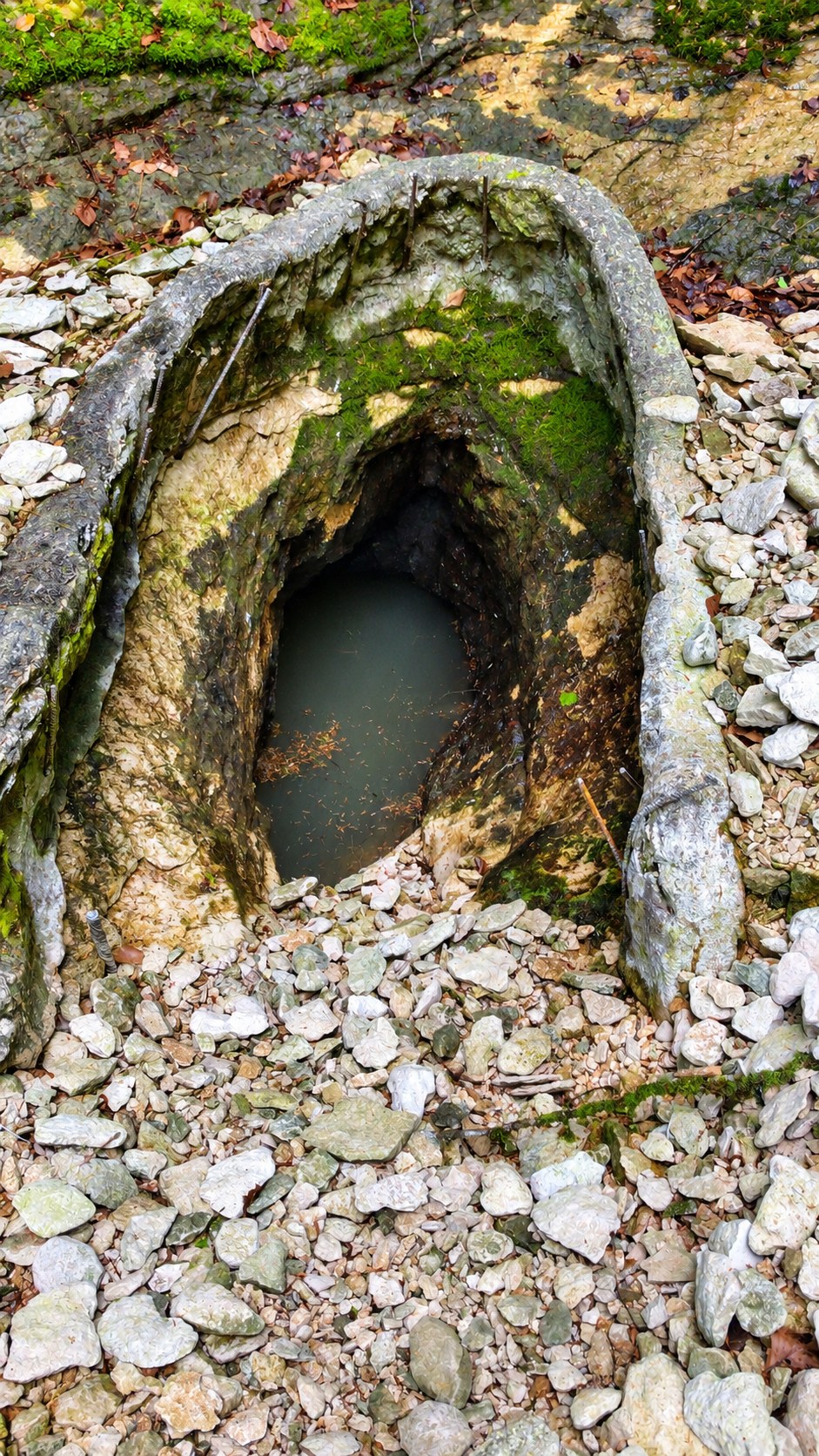


A clear resurgence in Haute-Marne with low passages, diaclases, dry intermediate sections and a network whose known development grew from 405 to 580 metres through later exploration.
Source de la Dhuit, also known as Fontaine de la Dhuit, lies near Bettaincourt-sur-Rognon in the municipality of Roches-Bettaincourt. The resurgence drains the Plateau de Heu. At high water, a temporary stream may emerge from the entrance and flow into the Rognon farther downstream.
A striking feature is the clear water. Even at higher water levels the water can remain clear, while the pale limestone provides good visibility. The entrance itself is relatively narrow. Farther in, low horizontal passages, diaclases, bedding-plane passages and larger sections alternate.
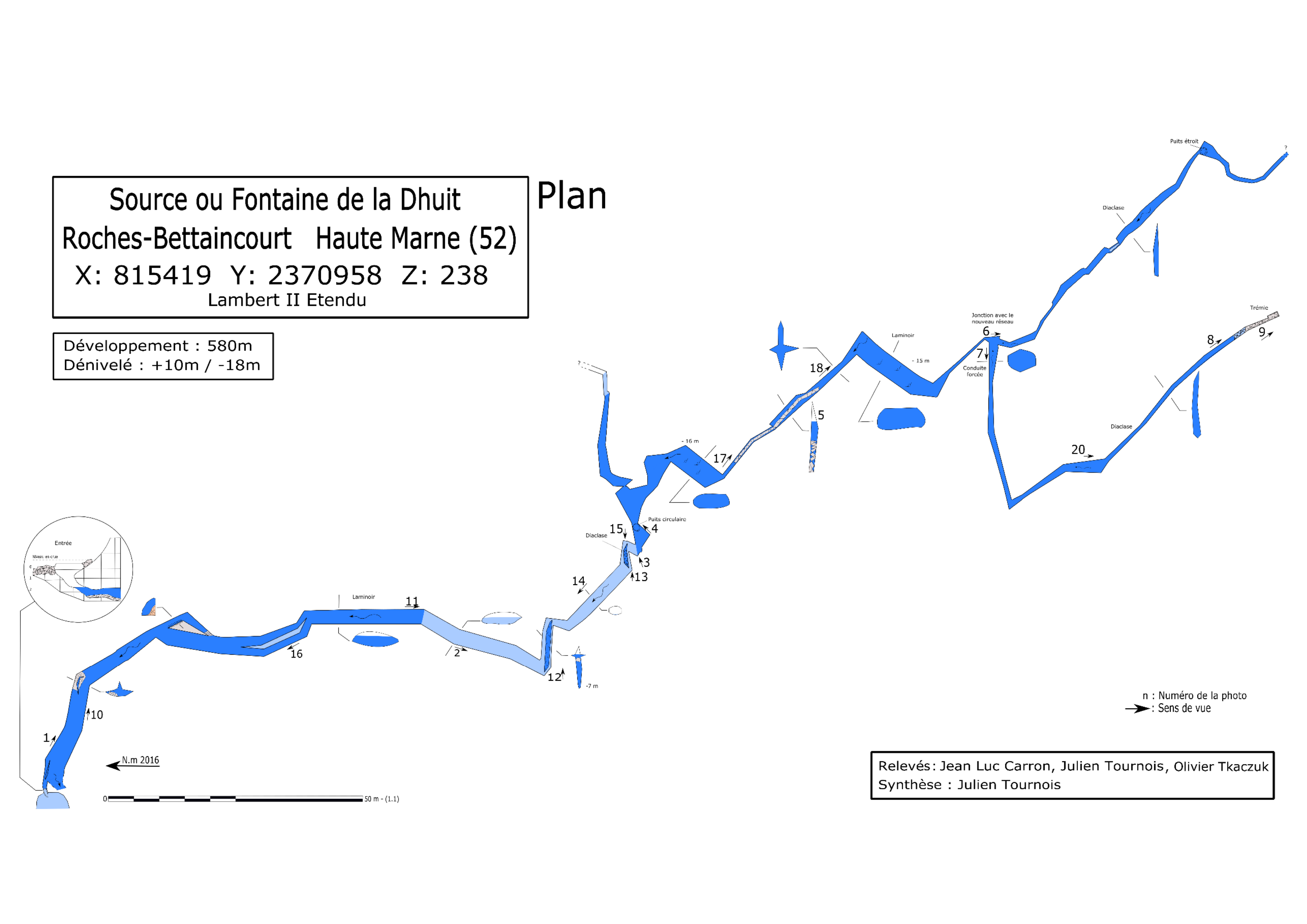
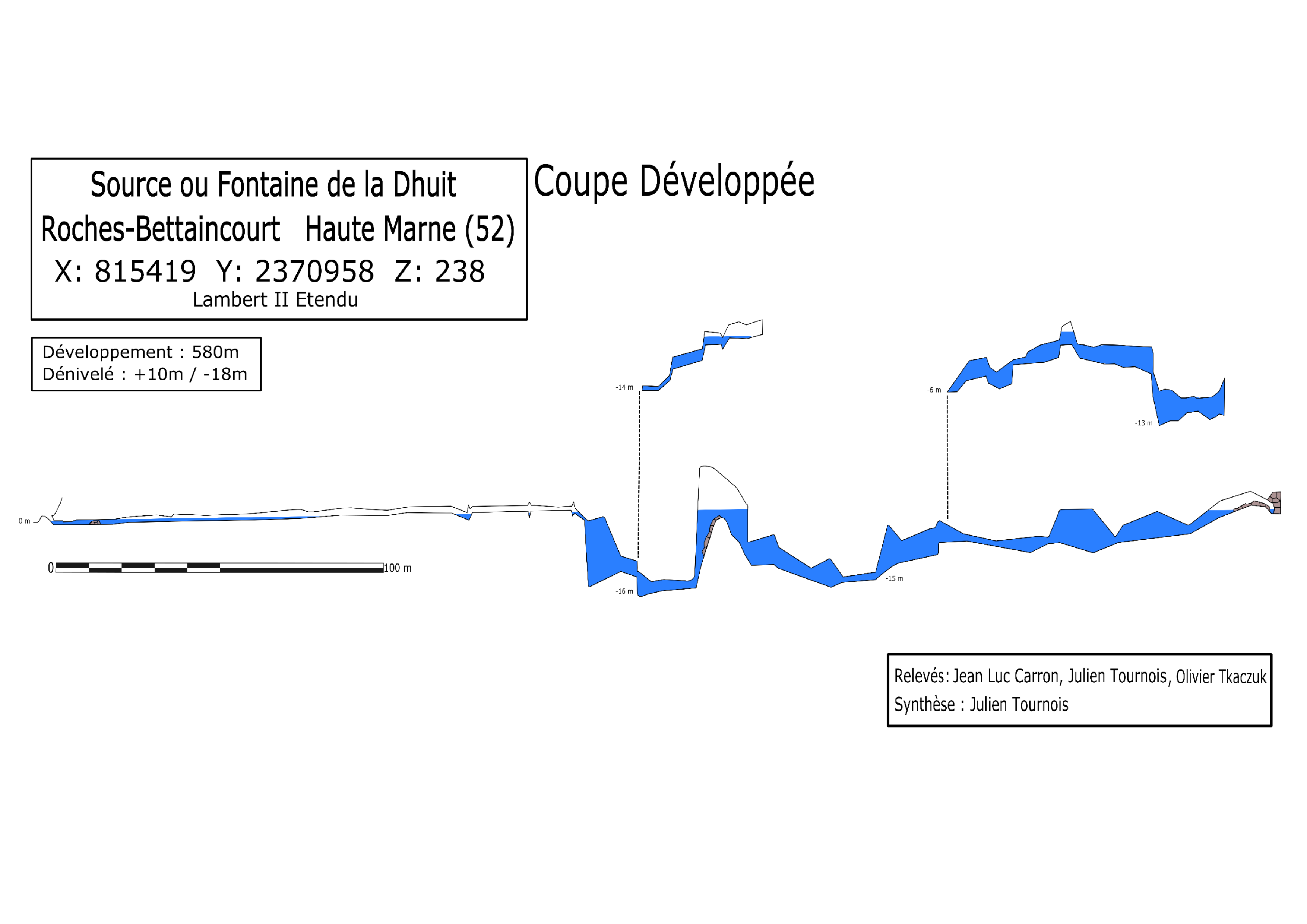
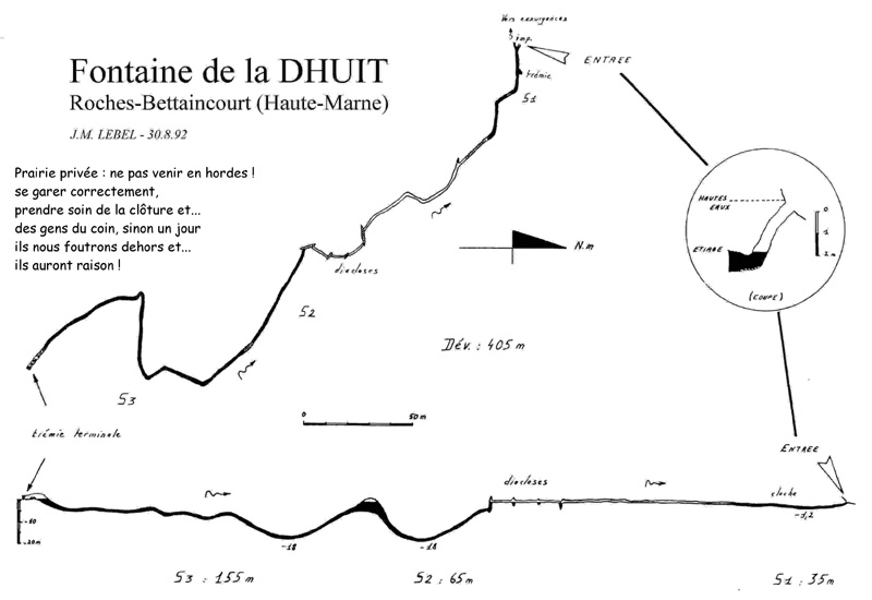
The historical 1992 topo divides the system into three sumps of approximately 35 m, 65 m en 155 m and states a total development of 405 m. Later exploration revealed an active parallel network. As a result, the modern topography gives 580 m ontwikkeling and a vertical range of +10 m / −18 m.
In the more recent description, the first underwater section is about 80 m long. At low water, this is followed by roughly 100 m of semi-flooded passage and 60 m of dry passage. Farther on are low passages around −16 and −18 m. About 300 m from the entrance lies the junction to the newer network; the main route continues towards a large diaclase and ends at a collapse.
The first observation of a passable underwater passage dates from 1967. From 1971 onward, the first cave-diving explorations were carried out, including by Bertrand Léger, Jean-Louis Camus, Jacques de Schryver and Yann Guivarch. Jean-Marc Lebel produced the well-known topo of the system as it was then known in 1992.
After several collapses at the entrance, it was cleared and protected several times. From 2011 onward, an active parallel network was explored. In early 2017, Jean-Luc Carron, Julien Tournois and Olivier Tkadzuk produced a new complete topography.
The modern topography consists of a Plan and a Coupe développée. Both state a development of 580 m and a vertical range of +10 m / −18 m. The historical 1992 topo by J.M. Lebel is included below for comparison.
Bettaincourt-sur-Rognon · Haute-Marne · France
📍 Open in Google Maps →Practical information about parking, walking distance and GPS coordinates is based on first-hand location data. Cave conditions, access and local arrangements can change; always check them before a dive.